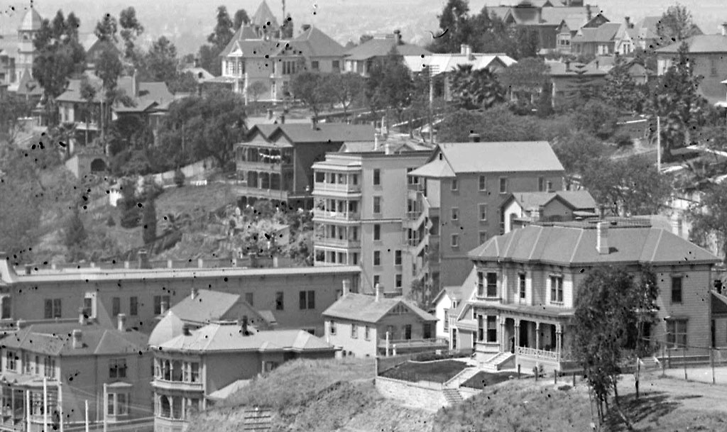
Some years ago, while browsing digital archives online, I came across this photo of a dilapidated old Los Angeles apartment building. I found its quirkiness to be instantly endearing. It looked totally ramshackle, but at the same time, its architectural details suggested to me that it might have had a much more elegant past.
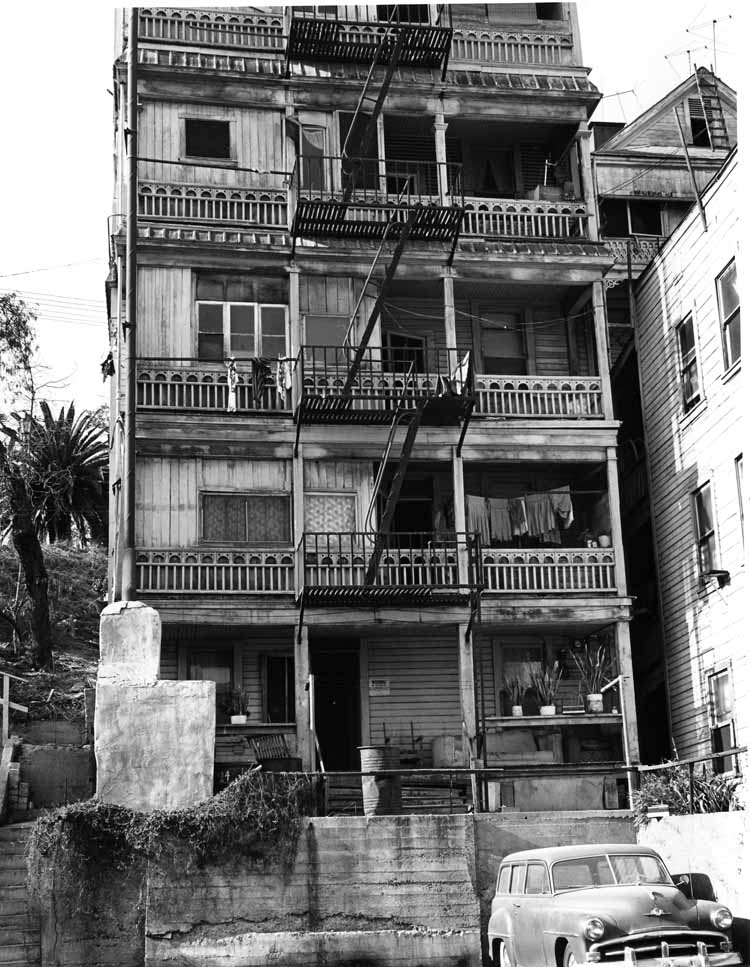
William Reagh, photographer. Courtesy California State Library.
So where exactly was this intriguing structure? No way to tell. The photograph's description contained no information more specific than it was taken on Bunker Hill in Los Angeles in 1963.
Not long ago, I found another photo of the building, but this time in color. Looking closely, I could tell it was taken around the same time as the black-and-white one (note the same three potted plants on the bottom floor porch). Moreover, this photo's online description did contain a specific address. It was 224 South Olive Street.
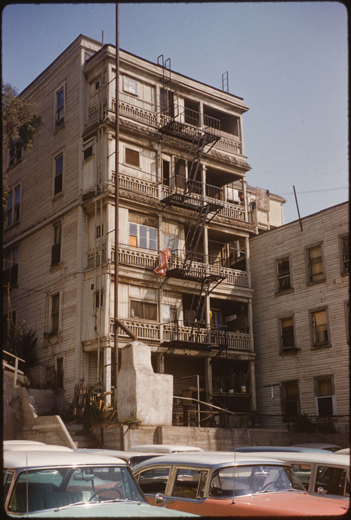
"Bunker Hill from Clay Street between 2nd and 3rd Streets, looking west," Palmer Connor, photographer. From the Palmer Connor Collection of Color Slides of Los Angeles. Courtesy of The Huntington Library, San Marino, CA. Link to full-res image.
Now I was anxious to find out what it looked like from the front. Thankfully, after a little more searching on the Huntington Library site, I found exactly what I was looking for. 224 is the building at right in the photo below.
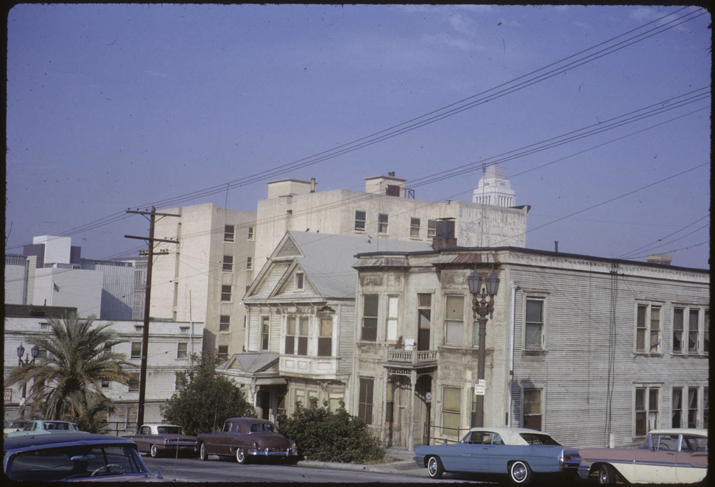
"Olive Street between 3rd and 2nd Streets," Palmer Connor, photographer. From the Palmer Connor Collection of Color Slides of Los Angeles. Courtesy of The Huntington Library, San Marino, CA. Link to full-res image.
More history sleuthing after the jump!
Next was to find out when 224 was built. The Sanborn fire insurance map for Los Angeles for 1888 shows a vacant lot at the site. Our apartment building appears for the first time on the 1894 Sanborn map, as 222 South Olive, and its name is given as "French Flats." Easter egg! Come to think of it, its architectural elements did have kind of a New Orleans flair to them...
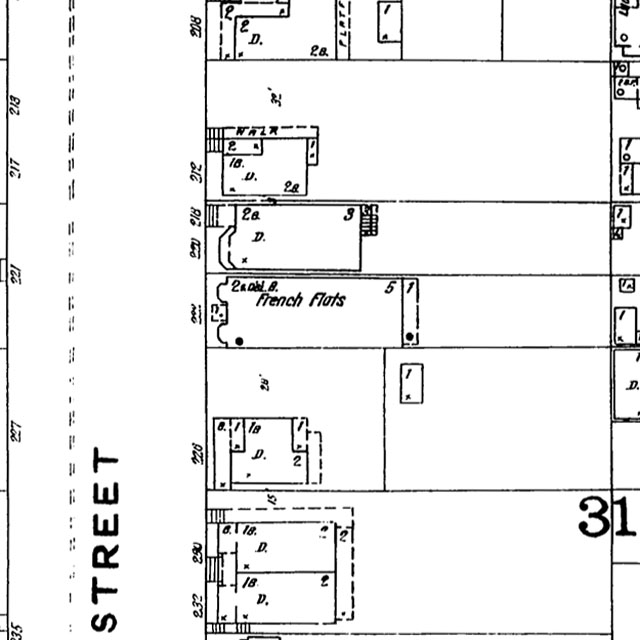
Los Angeles Public Library, Sanborn Map Collection.
Here's the 1904 Sanborn map showing our building as 224 South Olive.
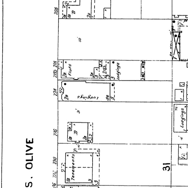
Los Angeles Public Library, Sanborn Map Collection.
1894 is also the first time that the address appears in the Los Angeles City Directory. And thanks to the amazingness of the internet, I was even able to find out who 224's residents were in that year. They were John B. and Grace E. Coates; Leo G. Hafner, an optician; Hannah Jarvis, a widow; Sargent H. Jewell, a stenographer; Milton M. Lyon, a pressman; Caroline M. Phelps, a widow; Emil J. and John C. Roller; Frank E. and Lucy A. Wright. There were only 7 flats at 224, though, so I'm guessing perhaps the widows Jarvis and Phelps might have been roommates sharing one of the apartments.
Given the occupations and life situations of its tenants, it's evident that 224 wasn't "elegant" as I initially imagined. It was solidly middle class. Judging by the photo below, though, it was quite pretty when it was first built, and the view of downtown the residents had from their back porches must have been grand. I know I would have considered myself fortunate to live in such a nice place.
"French Flats" in 1895 (center). "Looking south on Broadway from Court house, Los Angeles" (detail), Courtesy University of Southern California Digital Library.
Back to the question of age – if we assume that French Flats was built circa 1894, and the last photos of it were from 1964, then it was roughly 70 years old at the time of its demolition.
Finally, it turns out I had an unexpected personal connection to 224 South Olive. When I looked at Google Maps Street View to see what is there now, I had to smile when I saw that it is actually the exact spot where I got a parking ticket in 2010!
1 comments:
I love your blog. Thanks for sharing your photos, postcards, and info. I am a Raymond Chandler fan, and I think this site is wonderful.
Post a Comment